Cooper Creek flood modelling scenarios
CSIRO’s Gas Industry Social and Environmental Research Alliance (GISERA) has undertaken research to evaluate how resource development and climate change could impact on Cooper Creek and its floodplain.
Detailed flood modelling will help inform careful design of roads and other infrastructure on the floodplain and will also allow researchers to explore potential changes to water availability and persistence of critical waterholes.
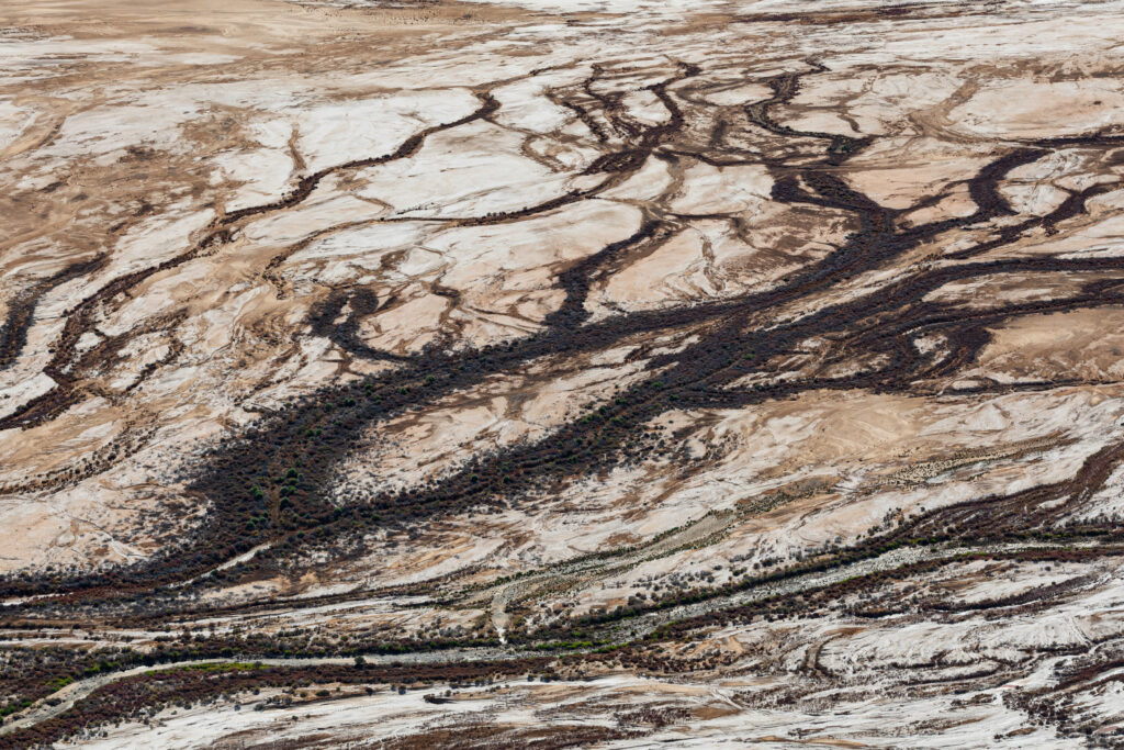
Cooper Creek floodplain
Cooper Creek floodplain.
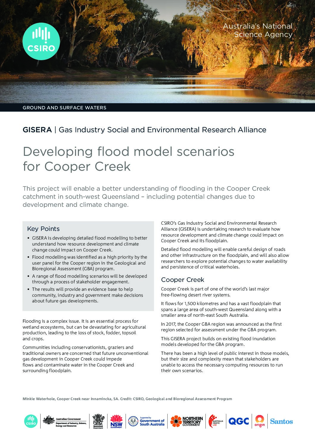
Cooper Creek is part of one of the world’s last major free-flowing desert river systems. It flows for 1,500 kilometres and has a vast floodplain that spans a large part of south-west Queensland along with a smaller area of north-east South Australia.
The Cooper Creek floodplain is about 32,000 square kilometers in size and floods frequently. It has highly variable terrain, very low gradients and very few data points. It is among one of the most complex floodplains in the world and is by far the most complex floodplain in Australia.
This GISERA project builds on existing flood inundation models developed for the Geological and Bioregional Assessment program (GBA, 2017-2021).
There has been a high level of public interest in the flood inundation models but their size and complexity mean that stakeholders are unable to access the necessary computing resources to run their own scenarios.
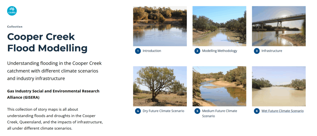
A key output from this project is the development of Cooper Creek Flood Modelling story maps, which allow users to explore various flood modelling scenarios.


Cooper Creek flood modelling story maps
This collection of story maps is all about understanding floods and droughts in the Cooper Creek, Queensland, and the impacts of infrastructure, all under different climate scenarios.
We show how floods move; down the Thomson and Barcoo Rivers, through their confluence to form the Cooper Creek – above Windorah and down to the Baryulah Floodplain, near the state border with South Australia.
We use computer models with real data to generate a series of snapshots over time, showing where the floodwaters flow in the catchment. Run these snapshots together (like timelapse on your smart phone) and you have a very useful animation, showing the flood overtopping the main channel and spreading over the floodplain. These data are then used to predict what may happen in the future with a changing climate.
First, we simulated changes to floods with and without structures (Infrastructure) on the floodplain using historical climate data. Then we simulated what may happen as the climate changes over the next 50 years. We built flood models to show three possible future scenarios — whether it gets drier (Dry climate), neither drier nor wetter (Medium climate), or whether it gets wetter (Wet climate).
Come and explore the Cooper Creek…
Final project output
Cooper Creek Flood Modelling story maps
This collection of story maps is all about understanding floods and droughts in the Cooper Creek, Queensland, and the impacts of infrastructure, all under different climate scenarios. We show how floods move; down the Thomson and Barcoo Rivers, through their confluence to form the Cooper Creek – above Windorah and down to the Baryulah Floodplain, near the state border with South Australia.
Extras
Developing flood model scenarios for Cooper Creek
This fact sheets summarises the results of a CSIRO research project which used modelling to improve our understanding of floods and droughts in the Cooper Creek catchment in Queensland.
Developing flood model scenarios for Cooper Creek
This fact sheet describes CSIRO research project activities designed enable a better understanding of flooding in the Cooper Creek catchment in south-west Queensland – including potential changes due to development and climate change.
Project progress
This project is complete.
Project proposal
A detailed description of the project, budget and research milestones.