Digital twin predicts overland water flow
One of these predicted challenges is more intense monsoonal storms and for the Territory’s Beetaloo Sub-basin this means increased risk of erosion and damage to the region’s fragile soils and dryland ecosystems.
While much scientific focus is placed on predicting when and where extreme rain will fall, CSIRO researchers are also developing ways to predict how torrential surface water flows will interact with the land.
This ground-breaking research aims to help land managers in both agriculture and the gas industry to design and place infrastructure in a way that protects surface water and vegetation, and reduces erosion, soil damage, and dust.
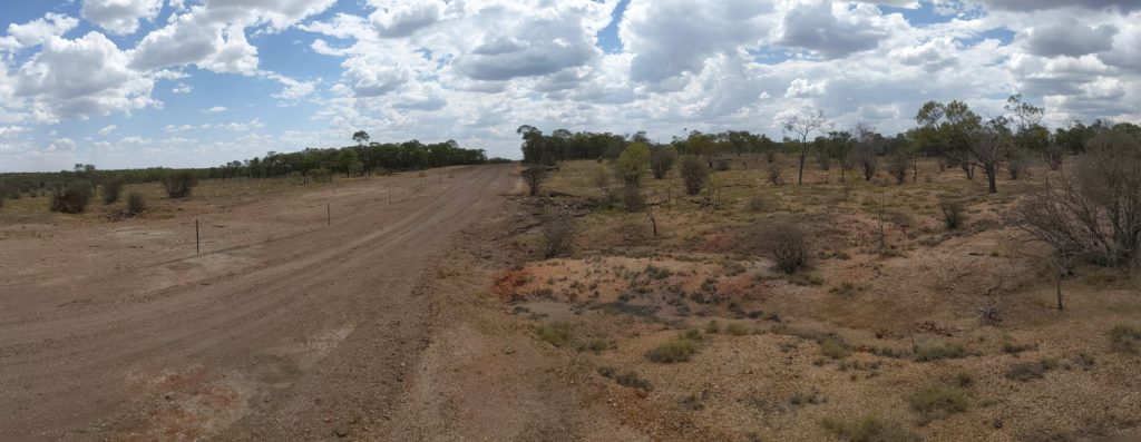
NT Beetaloo landscape
Depending on design, roads and other infrastructure can either minimise or contribute to erosion.
CSIRO scientist Dr Neil Huth leads a research team that has been using digital technologies to quantify and communicate impacts of gas development on grazing lands over the last six years.
In this latest project, funded through CSIRO’s Gas Industry Social and Environmental Alliance, Neil’s team combine high resolution aerial photography with sophisticated modelling and powerful computing to produce a “digital twin” of the Beetaloo Sub-basin landscape.
Flying parallel overlapping flight paths over the Beetaloo, the aerial photography captured billions of data points from multiple perspectives, allowing extremely precise geolocation of each data point in relation to all other data points.
With a highly accurate digital 3-D version of the Beetaloo acting as a virtual experimental laboratory, researchers were then able to use modelling software to visualise where rainfall would collect into runoff streams, and to also calculate the catchment area upstream of any point in the landscape.
When overlaid onto high resolution maps, a clear visualisation of where water will flow and gather in the landscape is produced.
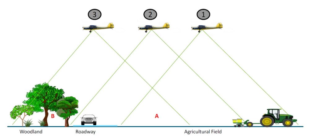
Aerial photography captured billions of data points from multiple perspectives to create a digital “twin” of the Beetaloo landscape.
Neil said the objective of the project is to develop high quality spatial data that will drive improved understanding and easier communication of the best land management practices to mitigate environmental risk.
“When it comes to extreme rainfall events, the risk to soils and infrastructure is often only visible to people after the damage is done,” Neil said.
“These high-resolution models help landowners and companies identify areas of high erosion risk in advance, allowing improvements to infrastructure design before the damage occurs.”
Another advantage of the modelling is the ability to identify different land types which may require a different land management approach.
For example, areas with low levels of grass cover caused by cattle grazing or poor soil health are at higher risk of erosion.
Satellite data can be used to highlight areas of poor land condition across the landscape.
When integrated with waterflow maps and gas and farm infrastructure, land managers can better identify areas needing more attention. These tools help minimise risk and maximise benefits.
Careful design and location of gas infrastructure such as roads, camps and fence lines can provide opportunities that benefit farmers and developers while helping to protect the environment.
The area selected for this research project included existing infrastructure development, proposed future development, and features a range of environmental conditions, including soil types, vegetation diversity and hydrology.
The Beetaloo Sub-basin lies southeast of Katherine and spans approximately 30,000 square kilometres. It is one of Australia’s most prospective areas for shale gas production and one of five gas fields the Australian government plans to open up.
More information: