CSIRO science teams heading north for new GISERA projects
CSIRO scientists will head back to the Northern Territory’s Beetaloo Sub-basin later this year to learn more about remote ecosystems associated with hot geothermal springs, and to explore new ways to understand and monitor biodiversity using drones and satellites.
The Beetaloo Sub-basin contains large shale gas resources and has been identified as a potential area for onshore gas production. The community has concerns about the potential for long-term impacts of gas development on biodiversity, groundwater resources and greenhouse gas (GHG) emissions.
The two new research programs were approved by CSIRO’s Gas Industry Social and Environmental Research Alliance (GISERA) and are designed to reduce uncertainty about potential environmental and social impacts of proposed onshore gas development.
Hot-foot to Hot Springs Valley
The project investigating hot springs focusses on the Hot Springs Valley, an area northeast of the Beetaloo Sub-basin. The valley includes several spring complexes, which discharge hot water at temperatures ranging from around 42 to 65 degrees Celsius.
While the better-known Northern Territory springs such as those at Mataranka are well studied, there is limited baseline environmental data on the springs in the Hot Springs Valley.
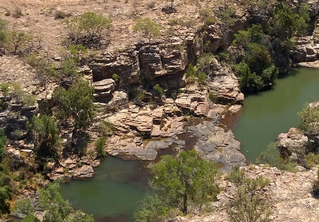
The Gorge Spring is one of several springs in the Hot Springs Valley in the Northern Territory.
CSIRO scientists will conduct a field campaign to collect detailed data on the geology, hydrogeology, ecology and atmospheric compositions of the Hot Springs Valley. This detailed investigation will build on limited data collected in previous surveys of the area. Engagement with local Indigenous groups will inform the research.
Baseline environmental data on the Hot Springs Valley springs will provide an important benchmark and evidence base for the protection and management of this environmentally and culturally significant area.
Drones, satellites and biodiversity
The GISERA biodiversity mapping research project involves the use of drones fitted with specialised sensing equipment to record data about the biodiversity and habitat of the Beetaloo Sub-basin.
CSIRO scientists will use drones (remotely piloted aircraft – RPA) fitted with LiDAR sensors (Light Detection and Ranging) to map key areas of the Beetaloo Sub-basin over repeated intervals.
UAV-LiDAR technology enables three-dimensional (3D) reconstruction of landscapes and vegetation (habitat) in fine detail, over large areas. RPA-LiDAR also provides a bridge between the data that can be collected in the field, and what can be measured from space. It provides a robust snapshot of habitat condition at a specific point in time. This can then be used to help validate satellite remote sensing products.
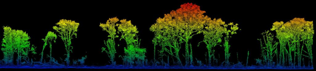
A three-dimensional (3D) image of Beetaloo Sub-basin vegetation. The colour scale shows height above ground level.
By combining high-quality 3D data at a local scale and validated satellite data over larger scales, this study will provide a method that could be used to help determine the effectiveness of mitigation measures and regulatory controls.
On completion, results from both projects will be available on the GISERA website.
Find out about the Hot Springs Valley research project.
Find out about the drones and biodiversity mapping project.
Learn about other GISERA research in the Northern Territory.