Canning Basin seismic array to deliver wealth of real time data
Involving the CSIRO, Australia’s leading science agency, the Geological Survey of Western Australia (GSWA) and Geoscience Australia (GA), the project will establish a long-term baseline of seismic monitoring data that will characterise the current natural seismic activity and cultural (human) seismic noise within part of the basin.
The project is being conducted through CSIRO’s Gas Industry Social and Environmental Research Alliance (GISERA) and addresses recommendations from the Independent Scientific Panel Inquiry into Hydraulic Fracture Stimulation in Western Australia (2018).
The Canning Basin is in northwest Western Australia, approximately 1,500 kilometres northeast of Perth. It is the largest sedimentary basin in Western Australia with an onshore area of about 530,000 square kilometres.
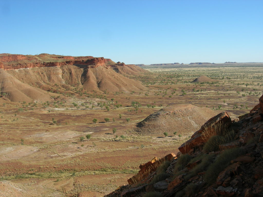
WA Canning Basin escarpment
Western Australia Canning Basin escarpment. Photo courtesy of Arthur Mory, WA Geological Survey and Resource Strategy Division
The northern onshore region of the Canning Basin is prospective for oil, conventional gas and shale gas resources. Increased seismic activity associated with potential hydraulic fracturing is an area of community concern.
This baseline study will distinguish any potential increase in seismic activity due to planned gas extraction operations from other seismic sources.
The GSWA have so far installed 10 new seismic monitoring stations and are in the process of final testing and commissioning remaining four.
Data from the monitoring stations will be sent in real time to the Geoscience Australia in Canberra via satellite transmission, and later to the Incorporated Research Institutions for Seismology in Seattle, U.S., via internet. The CSIRO has developed state-of-the-art seismological analysis techniques to process the data.
CSIRO researcher Dr Erdinc Saygin said the new array would fill a significant information gap about the background seismic activity of the Canning Basin.
“Data gathered by the new monitoring stations will provide important information to the community and regulators of baseline seismic activity,” Dr Saygin said.
“The data will also generate subsurface imaging to assist our understanding of the regional underlying geology of the Canning Basin.”
“Like everything else transformed by the digital revolution, the latest seismic monitors are smaller, cheaper, and far more sensitive.”
“Because the new monitoring stations are so sensitive we expect to be able gather data on seismic events that previously went undetected – as low or even lower than an order of magnitude of one.”
“When the array is up and running it will appear as if there is an increase in seismic events but in actual fact we will simply be processing a lot more data about a lot more events that were previously missed.
“It’s like the more you look the more you see, but in this case it’s the more we listen the more we will hear.”
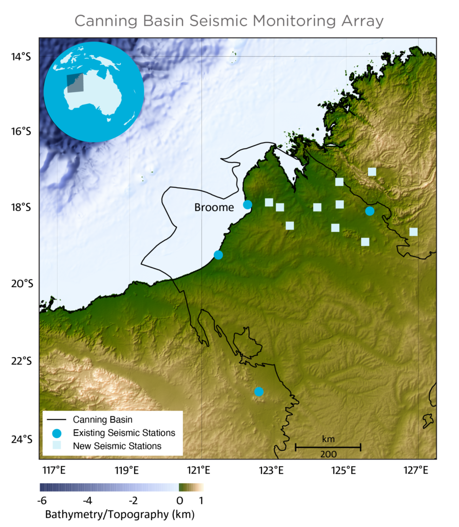
GISERA Canning Basin WA seismic map
Canning Basin WA seismic map
Dr Saygin said western and north-western margins of the Australian continent show a moderate amount of long-term natural seismic activity, with most of the events lying close to the offshore edge of the continental crust.
In 2019 a cluster of earthquakes occurred offshore from Broome, which produced a magnitude of 6.6 and was felt as far away as Perth.
The origin of the natural seismicity in the Canning Basin is associated with the ongoing deformation of the crust at the north-eastern margin of the basin.
To date, measuring seismic activity within the basin was limited due to the lack of seismic monitoring stations in the region.
Previously only four permanent stations existed within the basin, and these were unable to detect and locate small magnitude events.
To accurately form a baseline of current seismicity that will be useful for comparing against seismic events originating from industry activities, data on seismic events of magnitudes as low as 1.5 will be needed.
The proposed seismic array is expected to have a sensitivity range of magnitudes as low as 1 and potentially lower after CSIRO refines the subsurface velocity model by applying seismic imaging with the new array data.
In addition to detecting seismic events, the new array can also detect changes in groundwater levels in real time through analysis of measurable changes in the propagation of seismic waves.
Information gathered by the new array will be made available to the public in near-real time.